Bruce County launches Maps Hub
Bruce County has launched the
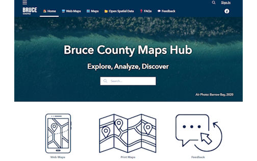
Bruce County Maps Hub, a centralized, user-friendly platform that improves how residents, business owners, visitors, and county staff access geographic information and mapping tools.
Whether you're submitting a planning application, researching zoning, exploring local trails or locating community services, the hub makes it easier than ever to find the information you need — all in one place.
Key features of Bruce County Maps Hub
- Bruce County Maps: The same trusted mapping tool, now on a new web page. Access detailed land information, road networks and high-resolution aerial imagery. Ideal for planning, development and real estate research.
- Web Maps: Explore dynamic maps showcasing public libraries, community development projects, visitor amenities and more.
- Printable Maps: Download ready-to-use PDF maps and brochures for off-line reference. Perfect for fieldwork or community meetings.
- Open Spatial Data: Developers and technical users can download data sets in various formats to support custom applications and analysis.
Why Use the Maps Hub?
- Planning Applications: Easily view zoning layers and property information to support efficient submissions.
- Business Development: Identify key locations and analyze land uses to inform investment decisions.
- Tourism and Recreation: Discover trails, parks and attractions with interactive tools that enhance your visit.
Developed by Bruce County’s geographic information system (GIS) team, using Esri’s ArcGIS Hub technology, this platform supports the county’s commitment to digital modernization and open data.
Residents and users are encouraged to
explore the Maps Hub and share their feedback through the on-line form to help shape future enhancements. The collection of maps and tools will continue to grow as new GIS products are released.
Explore the Bruce County Maps Hub today:
www.gis.brucecounty.on.ca.
 Written By
No bio for this author.




Related Stories
No related stories.